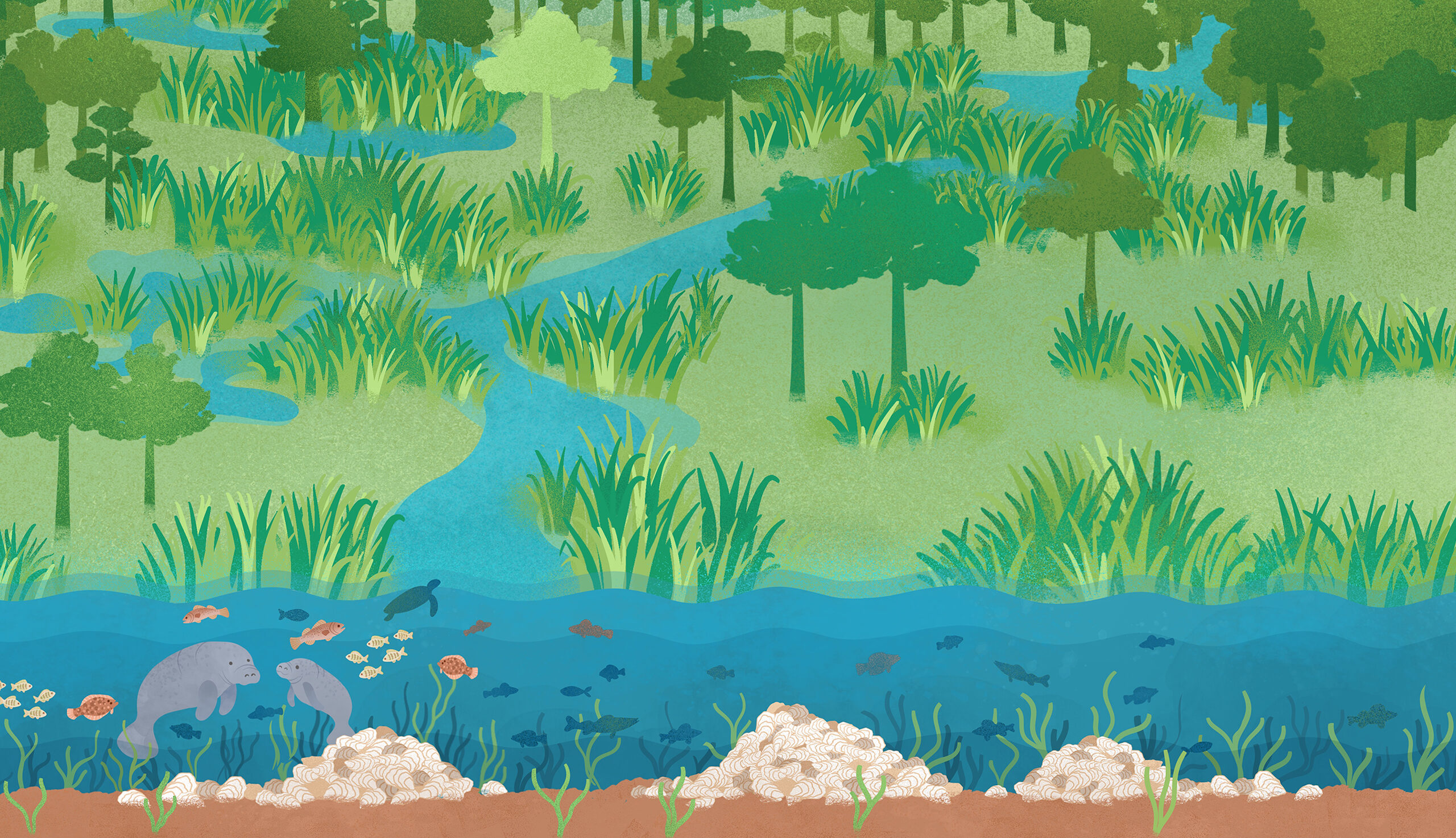
Habitats in our Watersheds
Longleaf Pine Forests:
Upland habitats are home to many species of plants and animals and play a critical role in water infiltration.
Wetlands:
These important barriers retain excess nutrients and pollutants, trap sediment, and protect us from flooding and wave energy.
Habitat Change:
Development, agriculture, and other human land uses alter the natural landscape.
Seagrass Beds:
Submerged grasses filter water, provide nursery and foraging grounds for wildlife, store carbon, and stabilize sediments.
Oyster Reefs:
These ecosystem engineers provide habitat to fish and shellfish, protect shorelines, and filter water for particles and nutrients.
Pensacola Bay Watershed
Oyster Reefs
Oysters are ecosystem engineers that provide habitat for fish, shellfish, and birds. They also help improve water quality by filtering water and stabilizing shorelines. Pensacola Bay oysters are culturally and economically significant and once supported a thriving oyster industry.
- Declining since the 1980s due to poor water quality and overfishing
- We no longer have enough oysters to support wild harvest
- Due to these declines, the oyster industry has turned to oyster aquaculture (farming)
- There is hope – the community came together to develop a plan to restore our oysters
980 acres of oyster reef found in 2010
480 acres of oyster reef found in 2021
The Florida Department of Agriculture & Consumer Services (FDACS) is responsible for regular bacterial testing of coastal waters to ensure wild and farmed oysters in the bay are safe to eat.
- Bacterial monitoring in the bay started in 1985
- Long term bacteria level trends determine which areas are approved or prohibited for oyster harvesting
- Additional short term closures may occur in response to environmental conditions
- The prohibited harvest area was expanded in 2022 due to consistently high bacteria levels, impacting aquaculture operations
- Efforts are underway to determine bacteria sources and remediate them
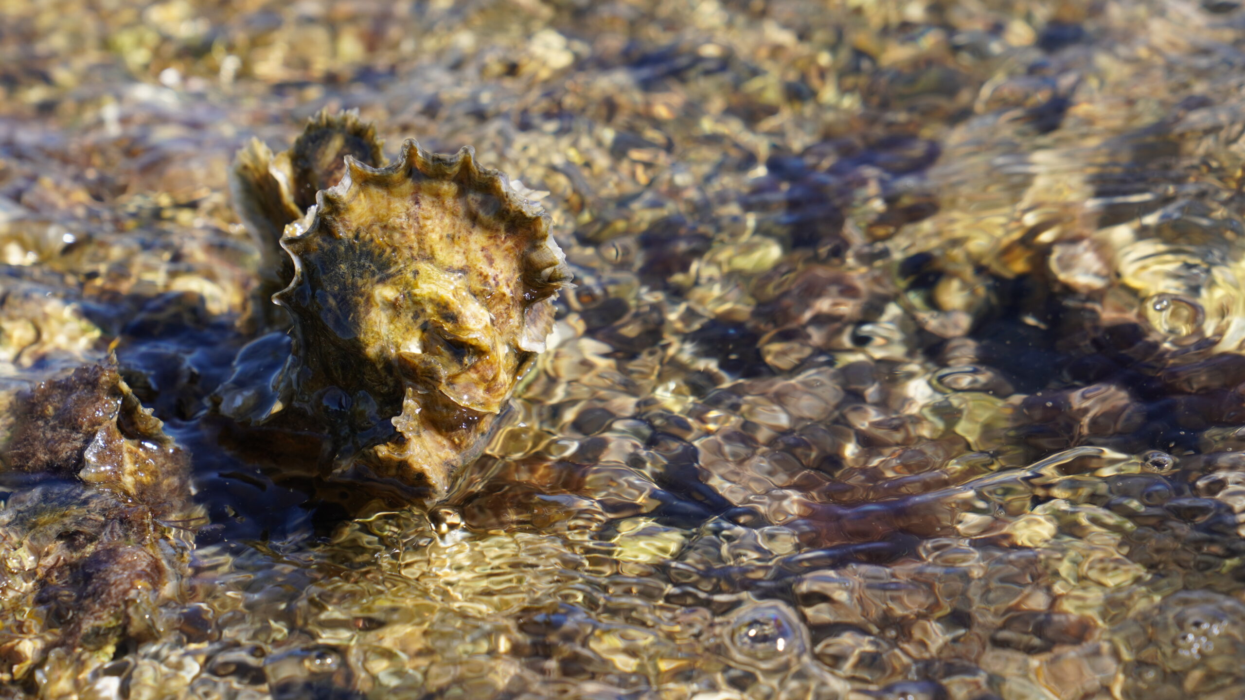
Pensacola Bay oyster
Photo: PPBEP
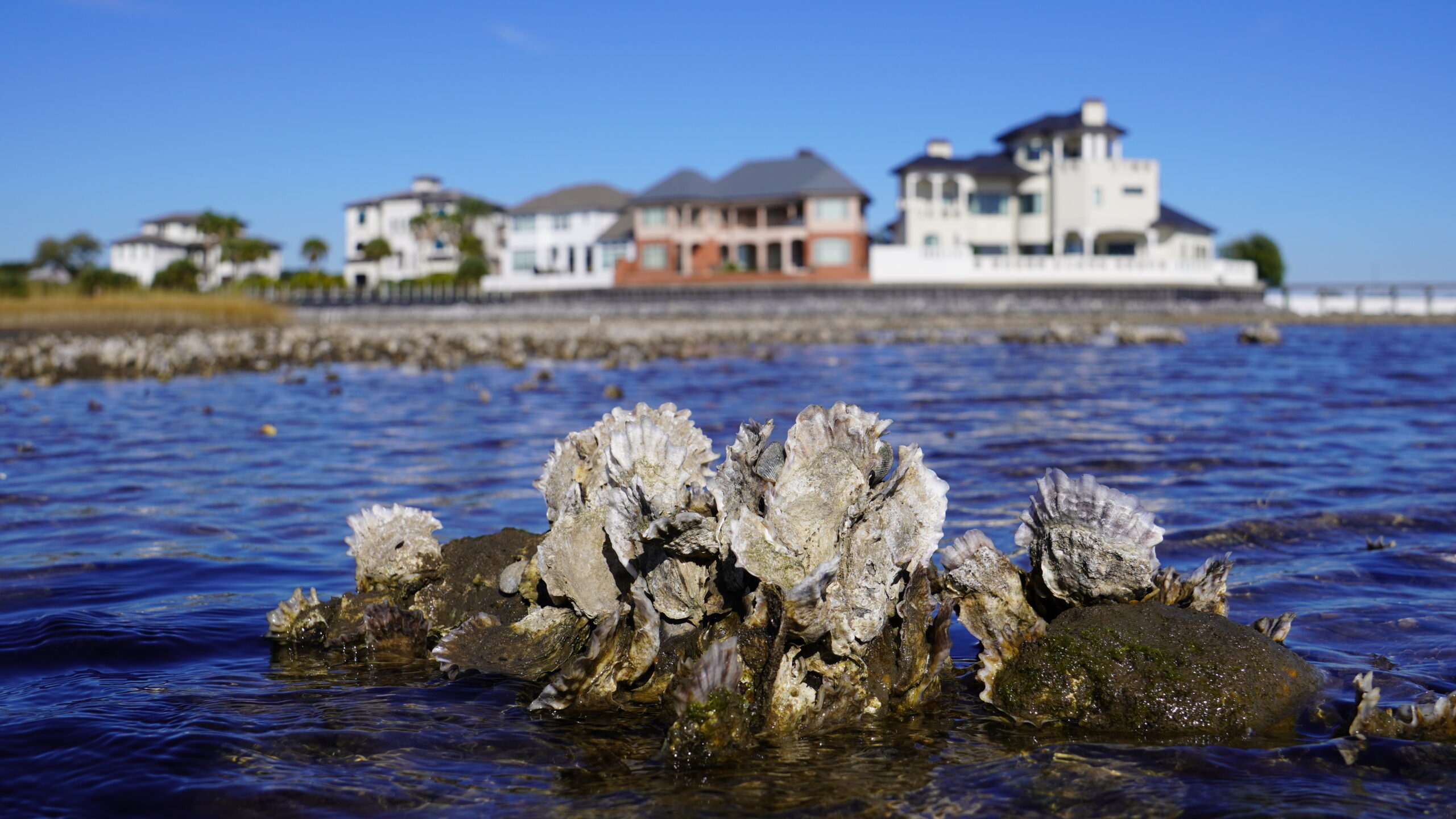
Intertidal oyster reef at Project GreenShores.
Photo: PPBEP
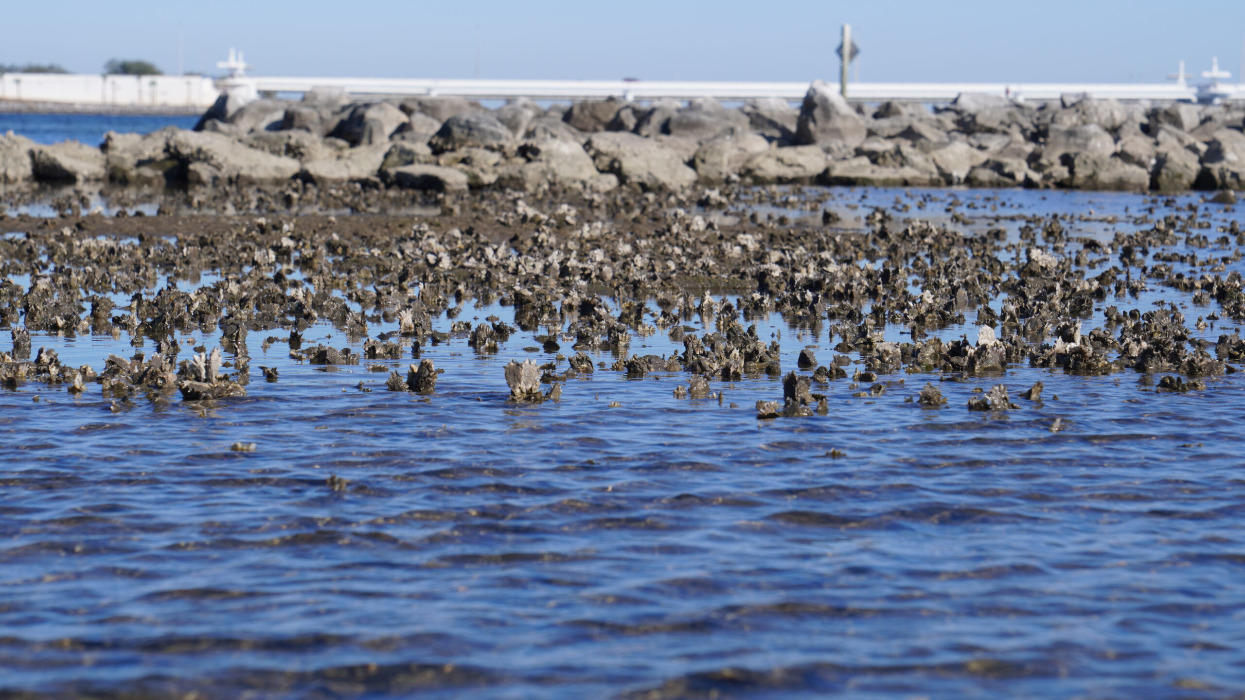
Intertidal oyster reef at Project GreenShores.
Photo: PPBEP
Help restore our oysters!
- Support restaurants that participate in oyster shell recycling programs
- Buy locally farmed oysters (when available)
- Support investments for water quality improvements
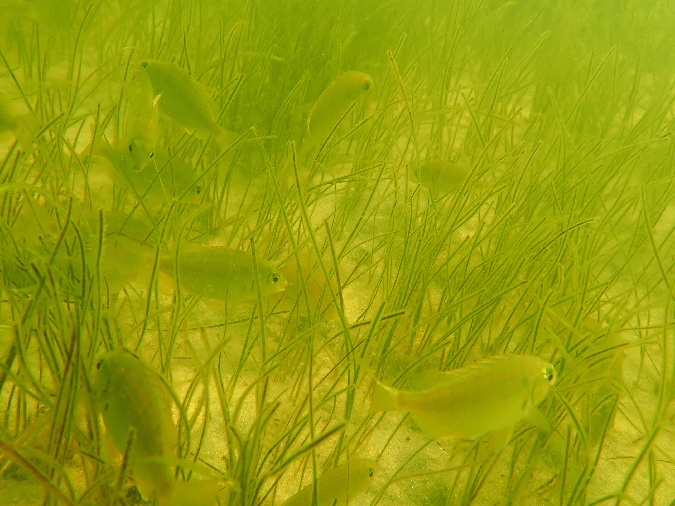
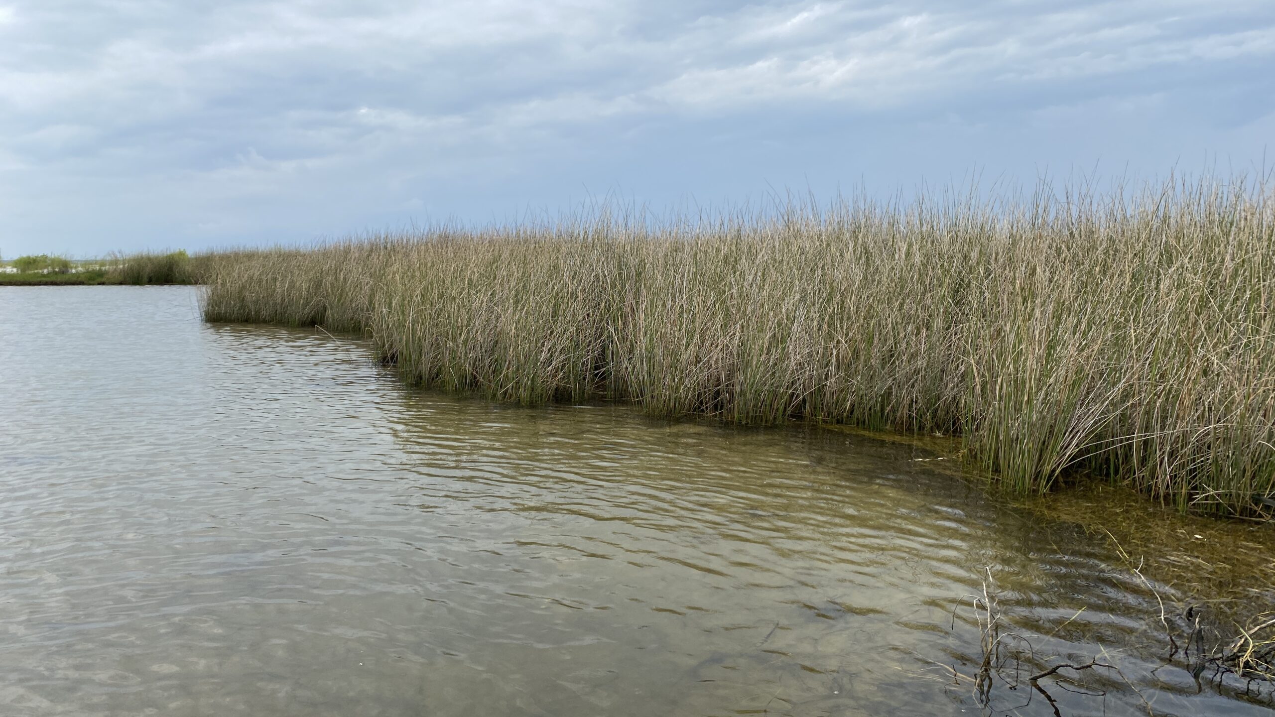
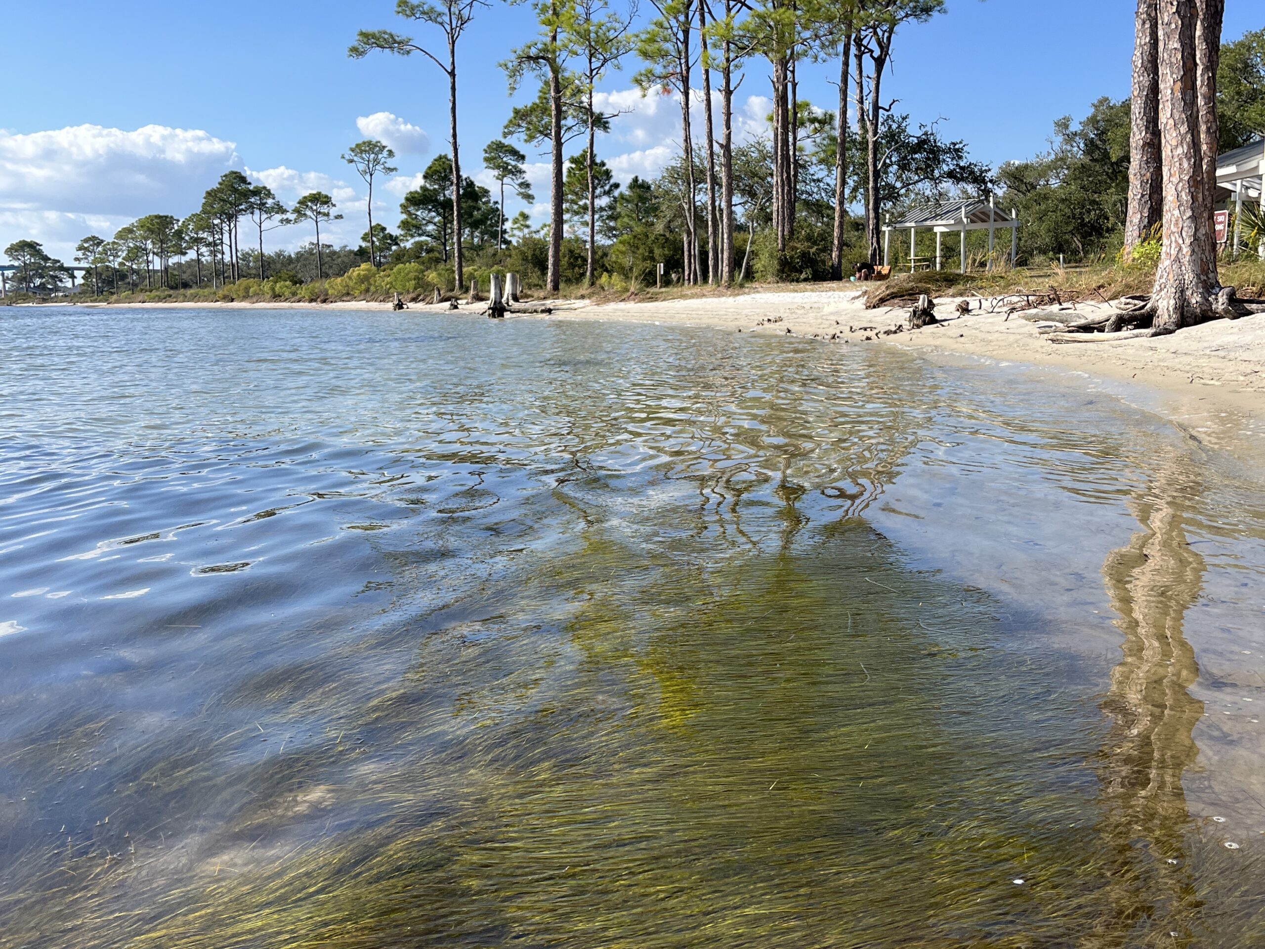
Seagrass Beds
Seagrasses are plants that grow entirely underwater in marine and brackish waters. They are important nursery habitats for many species, stabilize our shores, and filter our waters. Poor water quality and propeller scarring have historically led to seagrass declines, but in recent years, we have seen increases in seagrass coverage.
Mapping efforts are completed every few years to assess the health and coverage of seagrass beds. Why are some years missing data for certain segments of the Bay? Monitoring costs money! Researchers and agencies sometimes have limited resources to complete mapping for the entire bay. It’s our goal to complete regular mapping of Pensacola and Perdido Bays. We need your help to make it happen. Donate here!
Lower Pensacola Bay

- Large declines from 1960s to 1992 (~630 acres lost)
- Conditions improved from 1992 to 2017 with an additional 120 acres, but coverage is only about half of what it was in 1960
Santa Rosa Sound
- Large decline from 1960s to 1980s (about half lost)
- Relatively stable from 1980s to 2017, ranging from 2,800 to 3,600 acres
Seagrass habitat
Photo: PPBEP
Seagrass survey
Photo: USM Gulf Coast Research Lab
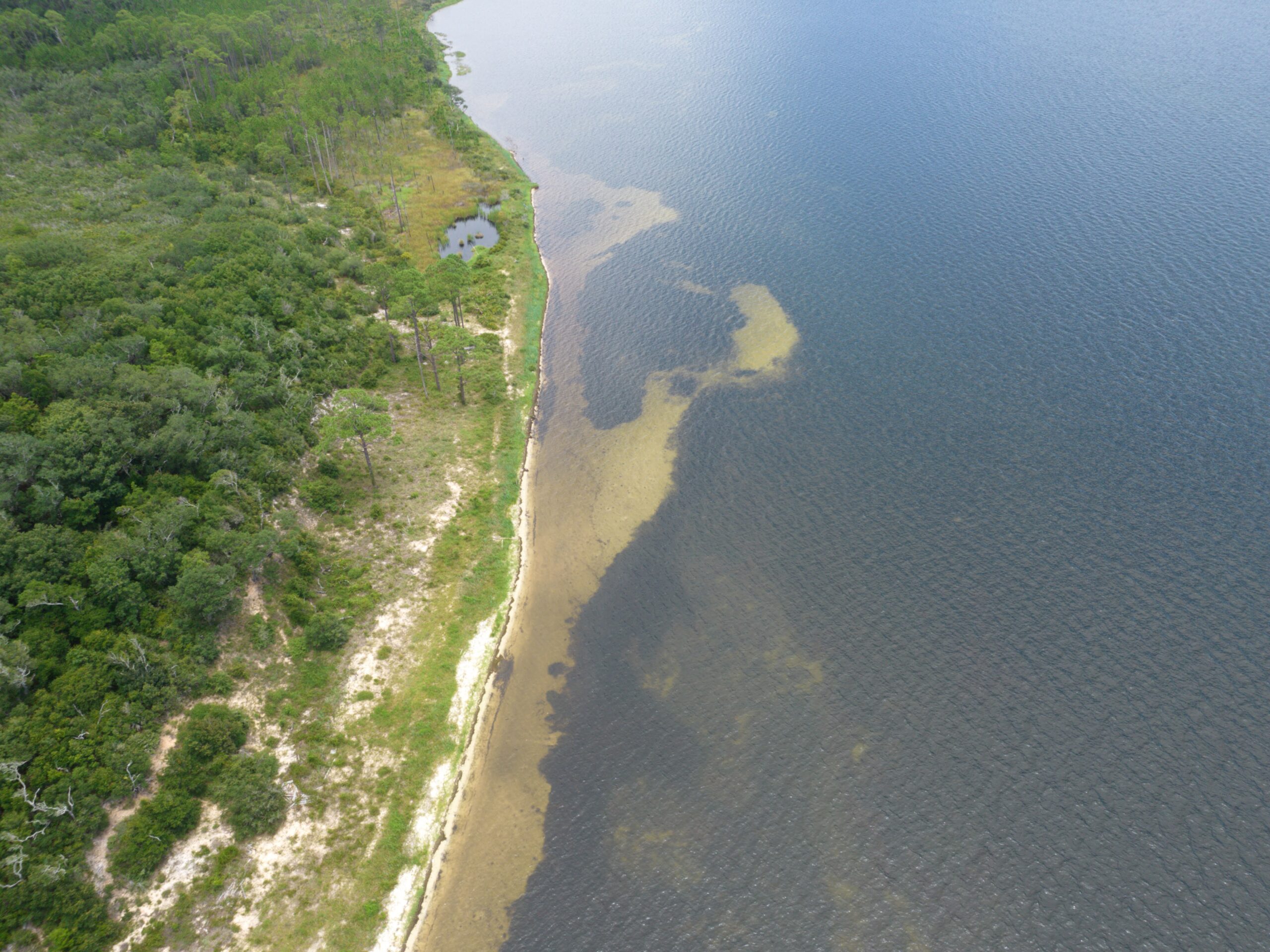
Aerial view of a seagrass meadow.
Photo: Darryl Boudreau, NWFWMD
Researchers preparing to complete seagrass survey. Photo: PPBEP
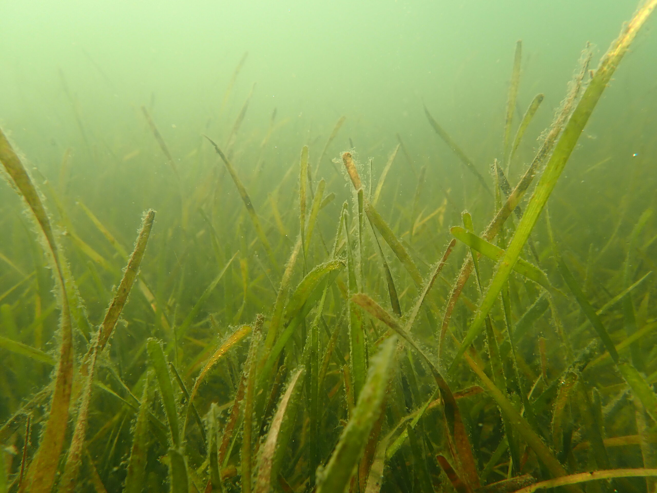
Seagrass bed
Photo: PPBEP
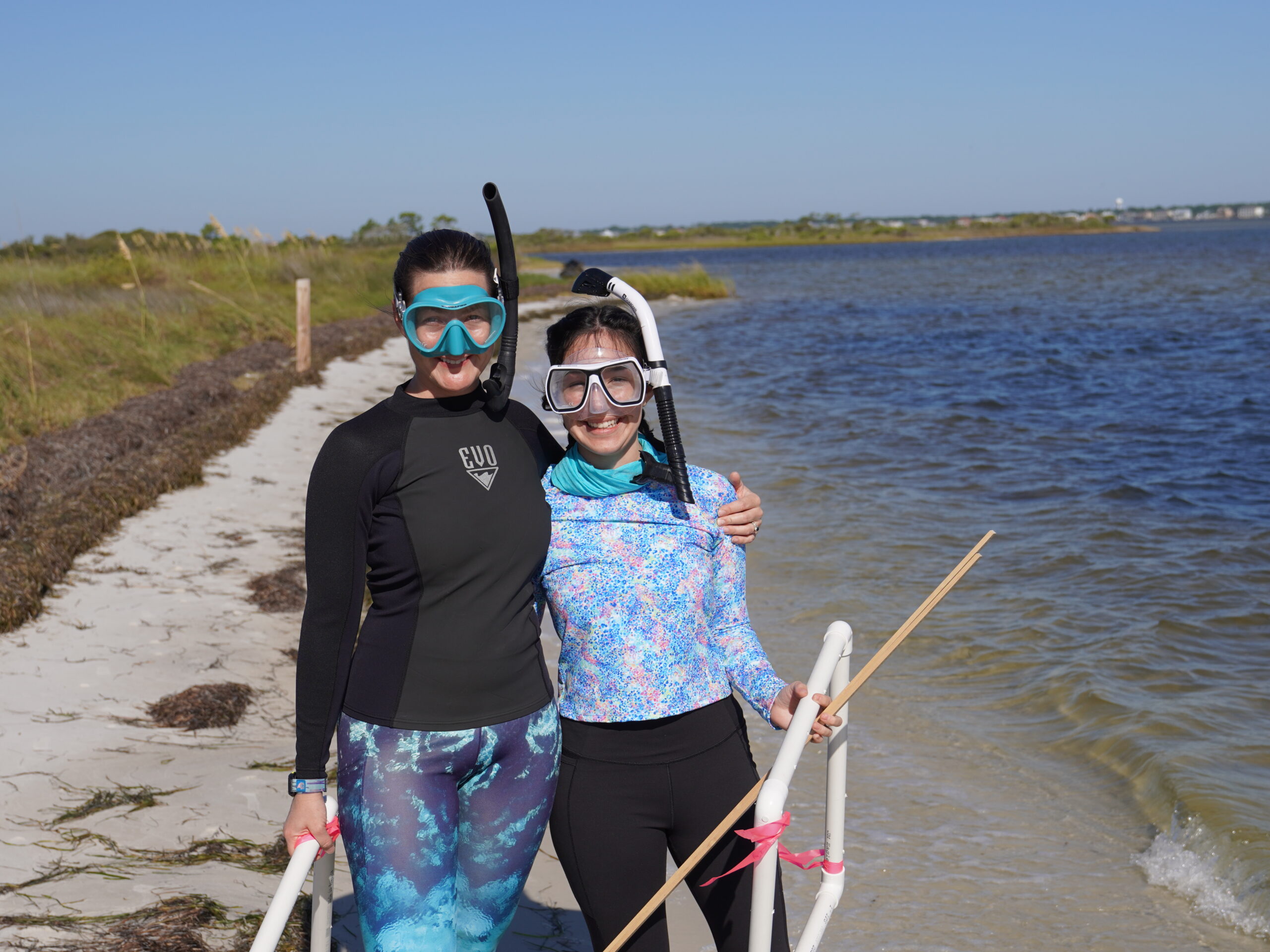
Be Seagrass Aware!
You can help prevent propeller scarring — trim up your motor when boating over shallow seagrass beds — your motor will thank you too!
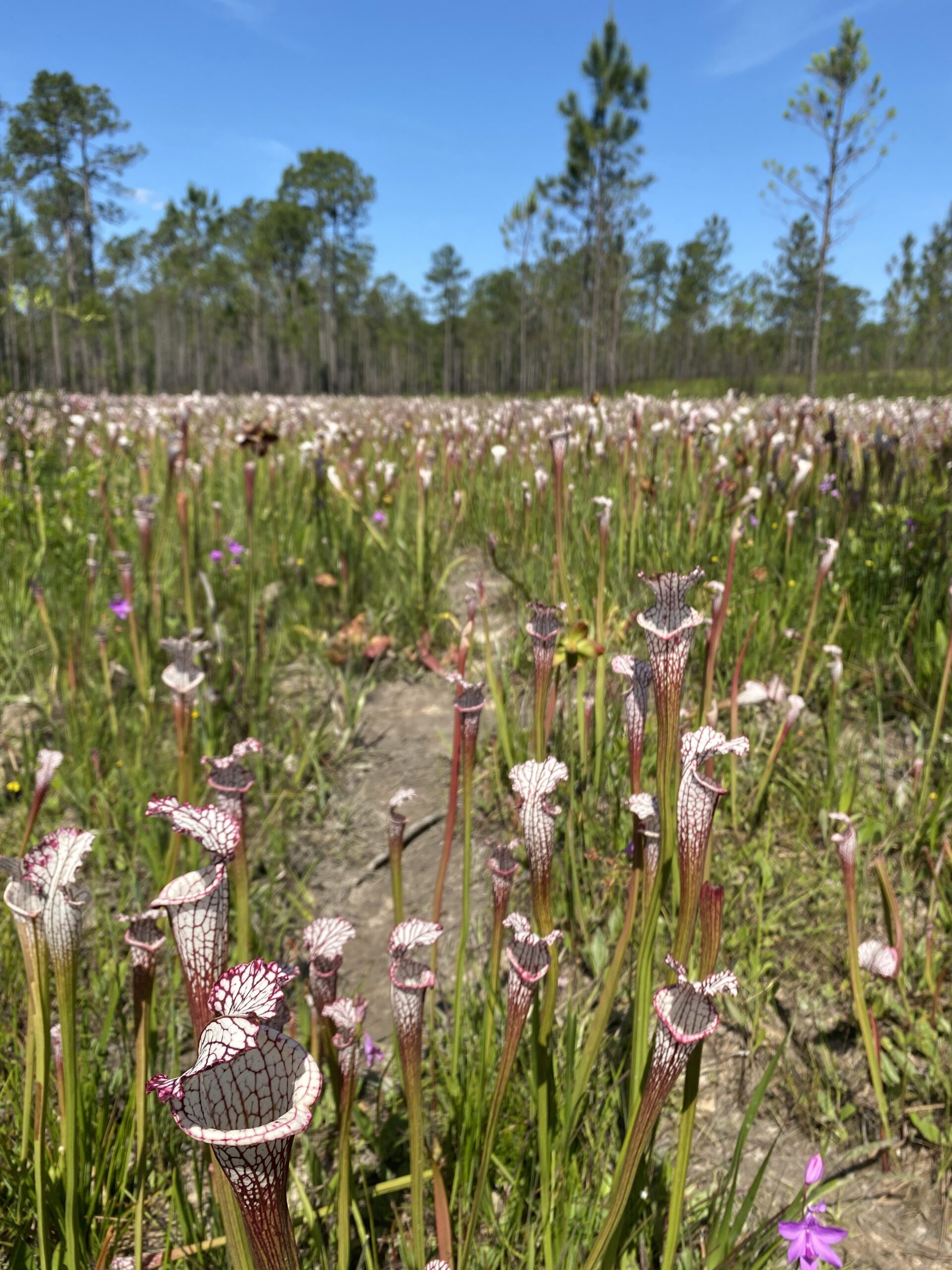
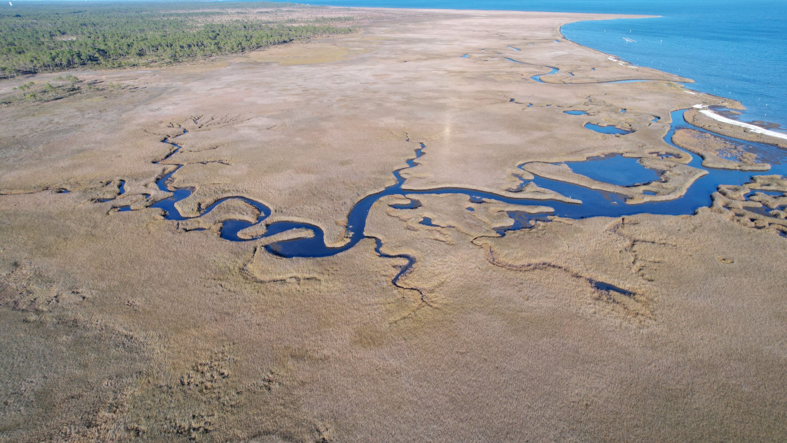
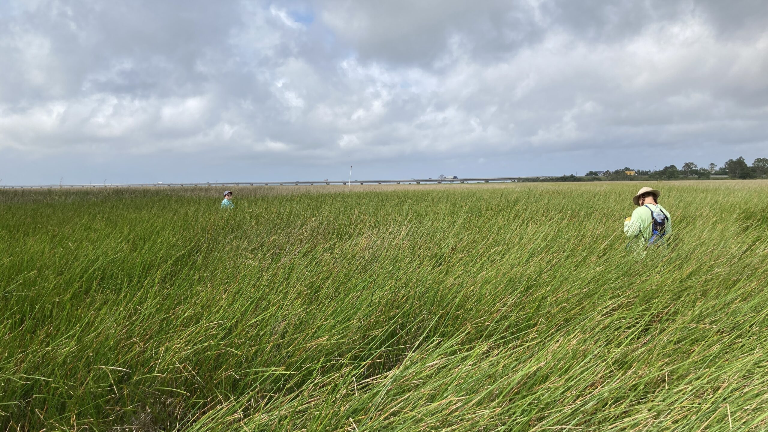
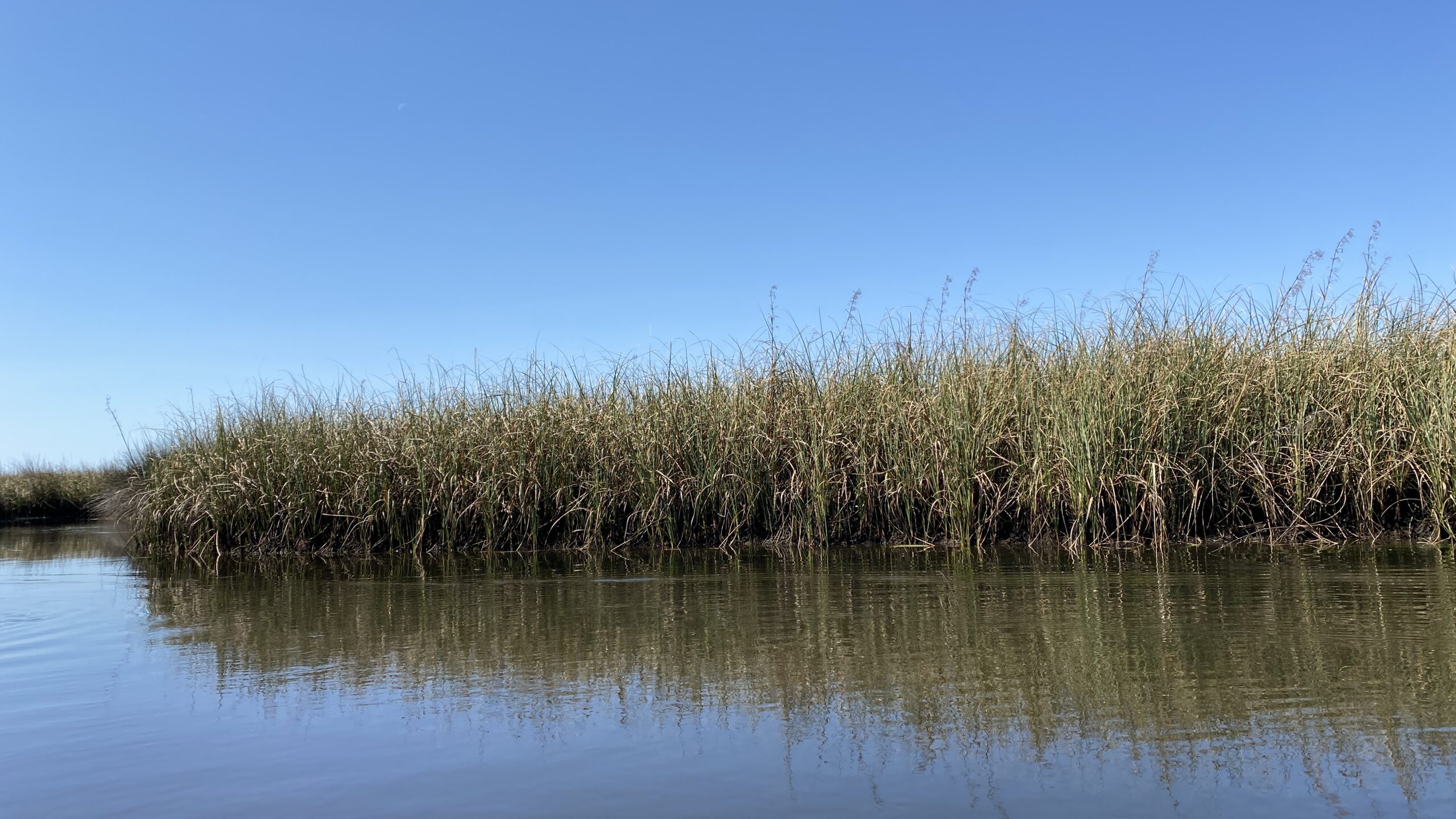
Wetlands
Wetlands are important transition zones between terrestrial and aquatic environments. They protect shorelines by buffering wave energy, filter water by trapping sediments and pollutants, and provide habitat for thousands of plants and animals. There are many kinds of wetlands including marshes, bogs, and swamps. The majority of wetlands in our watersheds are located along main river systems and represent large areas of relatively undisturbed habitat.
- Over the last 20 years (2001-2019), we have lost 18% of our total wetland cover
- In recent years (2016-2019), we have lost 1% of our total wetland cover, a slightly slower rate than the last 20 years
- Wetland change was calculated from the National Land Cover Database
In 2021, the condition of our estuarine wetlands were assessed as part of a national survey.
- More than 65 wetland vegetation species were identified.
- Black needlerush (Juncus roemerianus), sawgrass (Cladium jamaicense), and smooth cordgrass (Spartina alterniflora) were the most common species
- Overall, based on the indicators measured (e.g., soils, water quality, hydrology, vegetation), the surveyed wetlands appear to be in good health
- Increasing development and poor management practices may negatively impact wetlands in the near future
Garcon Point
Photo: Darryl Boudreau, NWFWMD
Black needlerush (Juncus roemerianus). Photo: PPBEP
Sawgrass (Cladium jamaicense). Photo: PPBEP
Smooth cordgrass (Spartina alterniflora). Photo: PPBEP
Protect our wetlands!
- Keep shorelines soft and living – consider a natural shoreline instead of seawalls or bulkheads
- Maintain vegetated barriers that act as buffers along wetland edges and streambanks
- Properly dispose of pet waste, toxic chemicals, and oil
- Practice smart fertilizer use
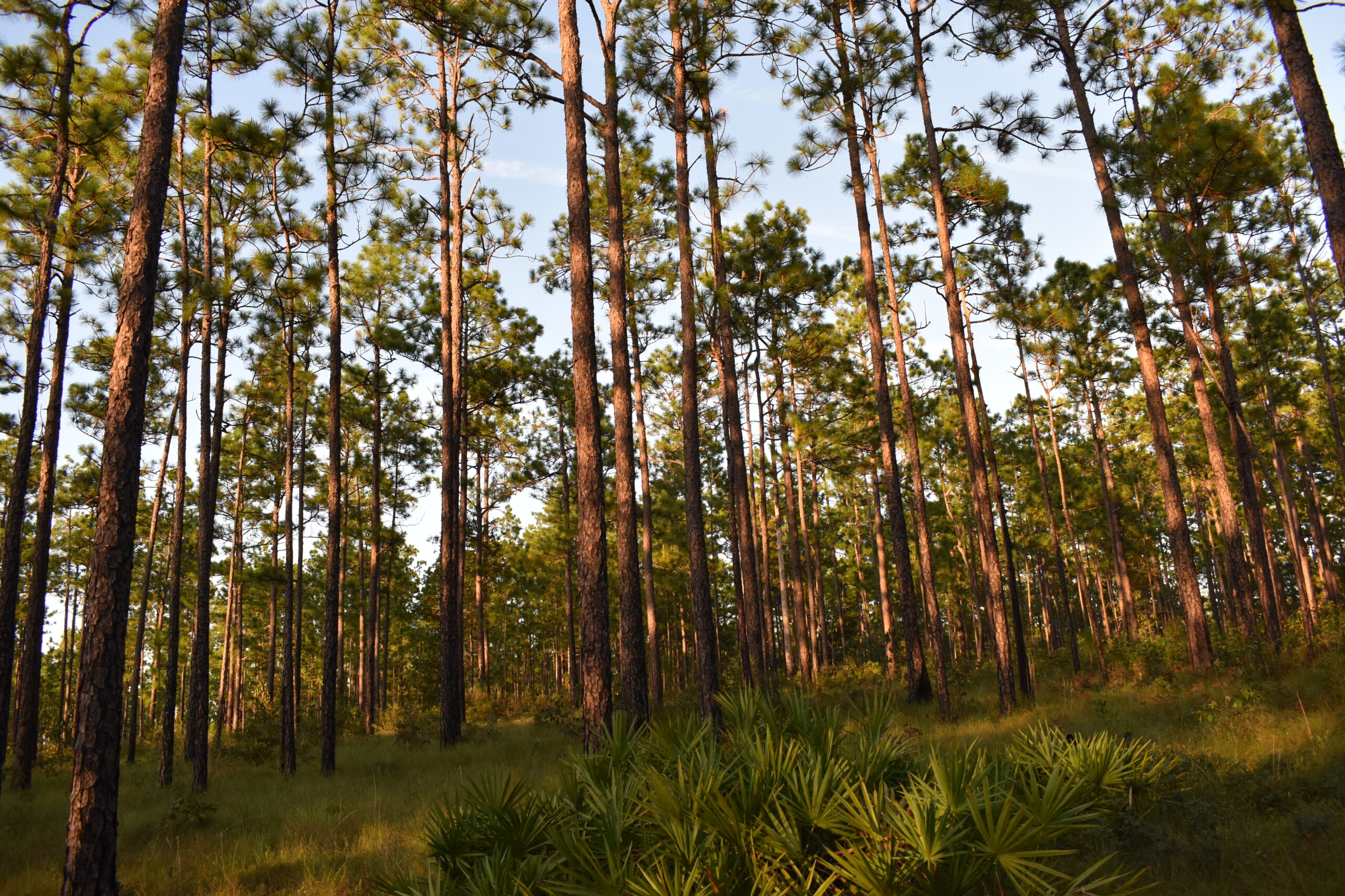
Longleaf Pine Forests
Longleaf pine forests support over 1,200 plant and animal species and play an important role in the history and culture across the Southeastern U.S.
- These pine forests once covered more than 90 million acres until the 1800s, when the logging industry decimated these forests with <3% of their historical range remaining today (LandScope America)
- Prior to logging in the 1800s, these forests covered >90 million acres across the Southeast
- Less than 3% of the historical range remains in the Southeast
- Natural reforestation and restoration are helping to recover these forests
- These ecosystems are fire dependent and historically burned regularly from lightning strikes
- Fragmented habitat has reduced the natural burning cycle and prescribed fire is used as a management technique to maintain habitat for important species like the red cockaded woodpecker and gopher tortoise
Protect our longleaf pine forests!
- Landowners – longleaf resources for forest management
- Support land conservation to help maintain natural habitats
- Consider a lasting legacy and preserve your land in perpetuity
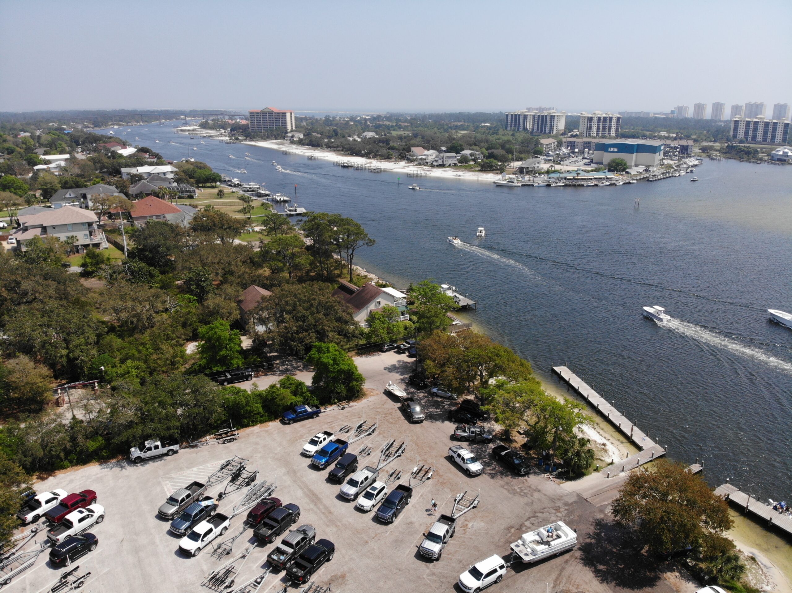
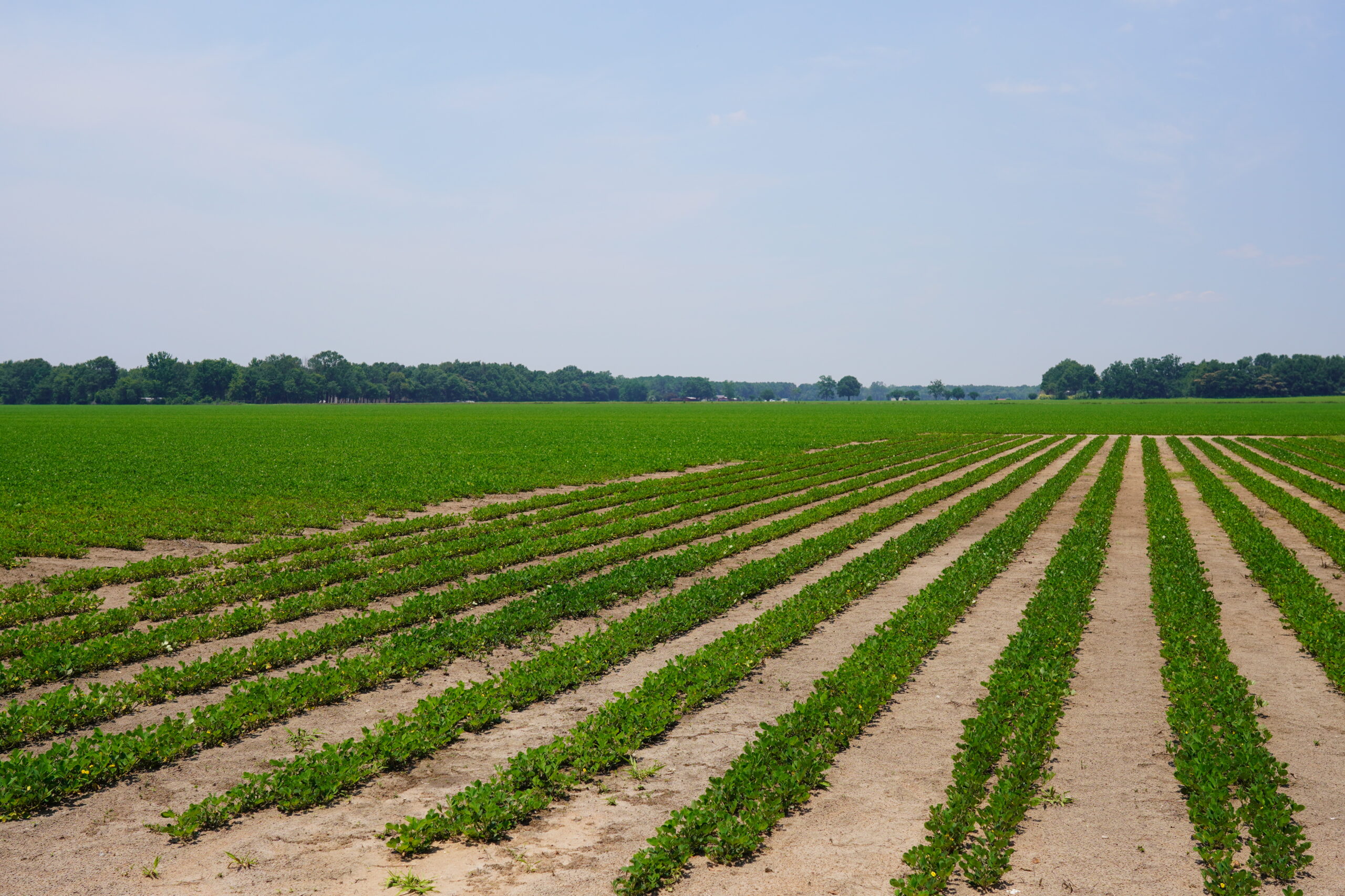
Habitat Change
Natural habitats and landscapes are altered as humans shape the land to fit our needs. Land use is continually changing among types, resulting in land conversions that can alternate over time (e.g., forested area is developed, developed area is later reforested). These changes alter habitat availability, water quality and flow, and potentially threaten wildlife and human health.
- There is an overall increase in habitat change across the watershed, but this is a negative change because we are losing our natural habitats
- Forest is the main land cover type in our watershed
- Coastal areas are experiencing rapid development
- Over the last 20 years (2001-2019):
- Developed lands have increased ~50%
- 5% increase in forest
- 18% loss of wetlands
- 15% loss of agricultural lands
- In recent years (2016-2019):
- 8% increase in development
- 6% increase in forest
- 42% loss of grassland and shrubland (includes barrier island dune habitats)
How you can help
- Smart city planning can help reduce urban sprawl
- Talk to your local elected officials! Well-written land development codes can help reduce the impacts of development
- Support land conservation to help maintain natural habitats
- Consider a lasting legacy and preserve your land in perpetuity
Perdido Bay Watershed
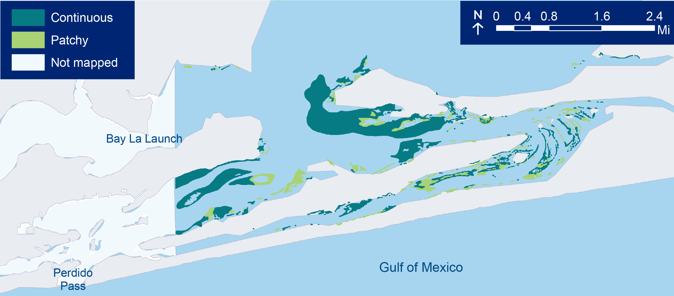
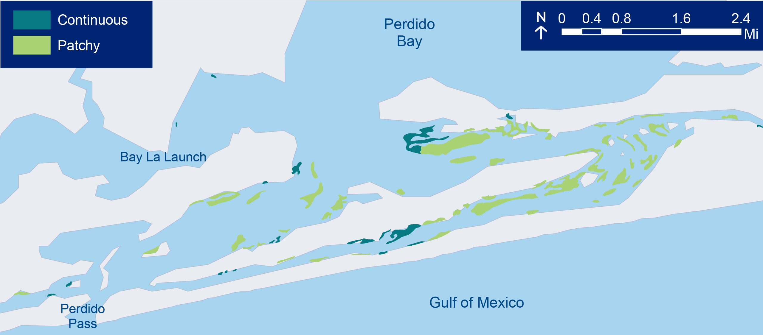
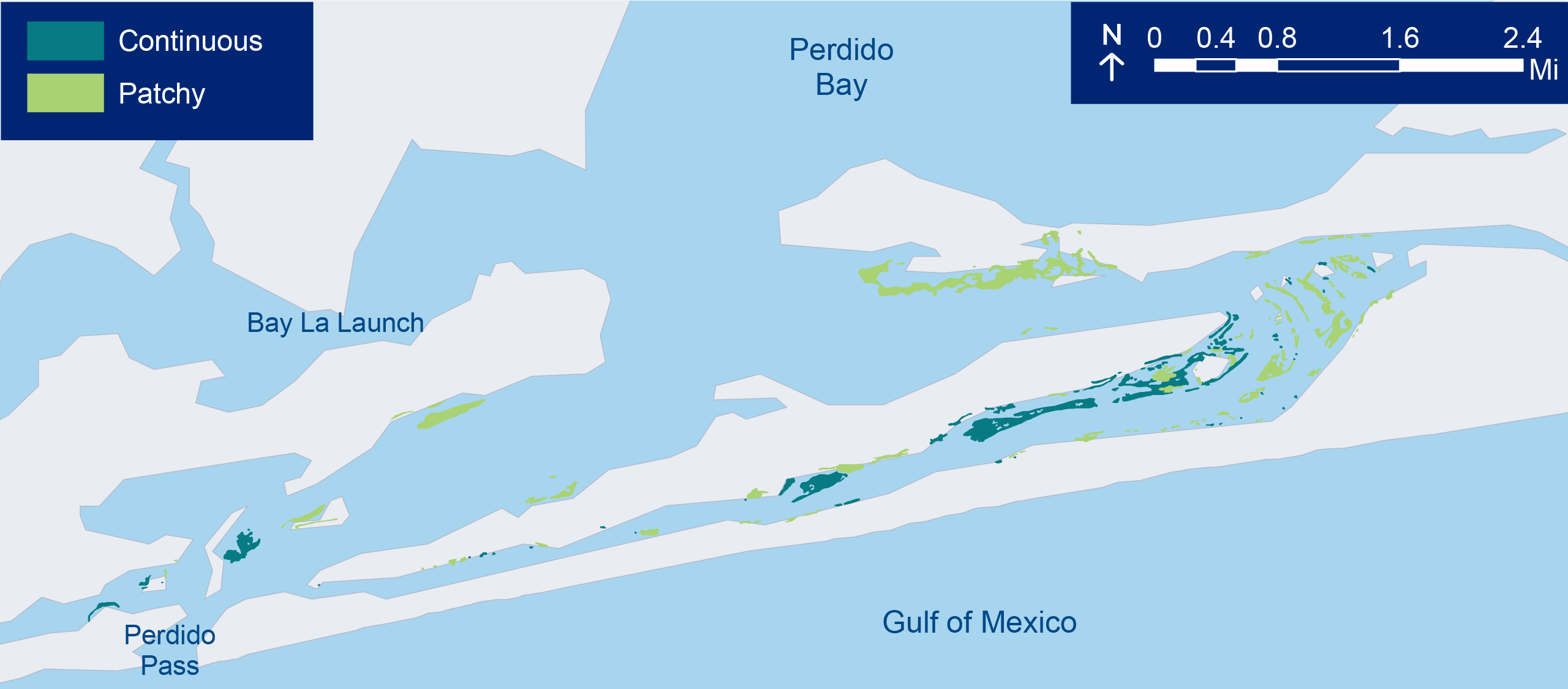
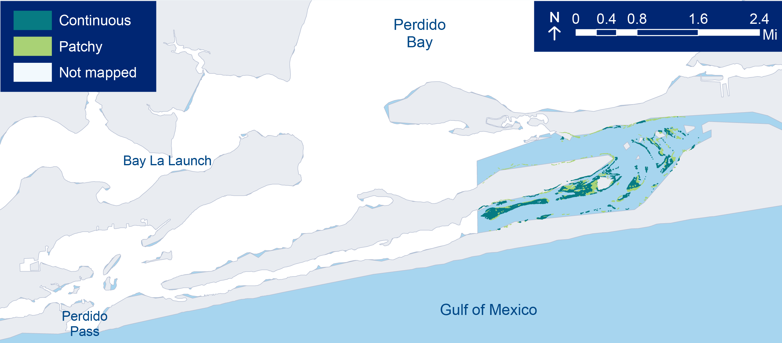
Seagrass Beds
Seagrasses are plants that grow entirely underwater in marine and brackish waters. They are important nursery habitats for many species, stabilize our shores, and filter our waters. Poor water quality and propeller scarring have historically led to seagrass declines, but in recent years, we have seen increases in seagrass coverage.
Mapping efforts are completed every few years to assess the health and coverage of seagrass beds. Why are some years missing data for certain segments of the Bay? Monitoring costs money! Researchers and agencies sometimes have limited resources to complete mapping for the entire bay. It’s our goal to complete regular mapping of Pensacola and Perdido Bays. We need your help to make it happen. Donate here!
Lower Perdido Bay
- Following a period of decline from 1987 to 2015, there has been an increase of ~200 acres since the most recent mapping effort in 2020
Big Lagoon

- Relatively small declines in coverage from 1960 to 2010
- Coverage has remained stable around 500-600 acres since 1960
Seagrass habitat
Photo: PPBEP
Seagrass beds at Big Lagoon State Park.
Photo: PPBEP
Aerial view of a seagrass meadow.
Photo: Darryl Boudreau, NWFWMD
Researchers preparing to complete seagrass survey. Photo: PPBEP
Seagrass bed
Photo: PPBEP


Be Seagrass Aware!
You can help prevent propeller scarring — trim up your motor when boating over shallow seagrass beds — your motor will thank you too!
Wetlands
Wetlands are important transition zones between terrestrial and aquatic environments. They protect shorelines by buffering wave energy, filter water by trapping sediments and pollutants, and provide habitat for thousands of plants and animals. There are many kinds of wetlands including marshes, bogs, and swamps. The majority of wetlands in our watersheds are located along main river systems and represent large areas of relatively undisturbed habitat.
- Over the last 20 years (2001-2019), we have lost 16% of our total wetland cover
- In recent years (2016-2019), we have lost 3% of our total wetland cover, a slightly faster rate than the last 20 years
In 2021, the condition of our estuarine wetlands were assessed as part of a national survey.
- More than 65 wetland vegetation species were identified.
- Black needlerush (Juncus roemerianus), sawgrass (Cladium jamaicense), and smooth cordgrass (Spartina alterniflora) were the most common species
- Overall, based on the indicators measured (e.g., soils, water quality, hydrology, vegetation), the surveyed wetlands appear to be in good health
- Increasing development and poor management practices may negatively impact wetlands in the near future
Perdido River Delta. Photo: Darryl Boudreau, NWFWMD
Black needlerush (Juncus roemerianus). Photo: PPBEP
Sawgrass (Cladium jamaicense). Photo: PPBEP
Smooth cordgrass (Spartina alterniflora). Photo: PPBEP
protect ouR wetlands!
- Keep shorelines soft and living – consider a natural shoreline instead of seawalls or bulkheads
- Maintain vegetated barriers that act as buffers along wetland edges and streambanks
- Properly dispose of pet waste, toxic chemicals, and oil
- Practice smart fertilizer use
Longleaf Pine Forests
Longleaf pine forests support over 1,200 plant and animal species and play an important role in the history and culture across the Southeastern U.S.
- These pine forests once covered more than 90 million acres until the 1800s, when the logging industry decimated these forests with <3% of their historical range remaining today (LandScope America)
- Prior to logging in the 1800s, these forests covered >90 million acres across the Southeast
- Less than 3% of the historical range remains in the Southeast
- Natural reforestation and restoration are helping to recover these forests
- These ecosystems are fire dependent and historically burned regularly from lightning strikes
- Fragmented habitat has reduced the natural burning cycle and prescribed fire is used as a management technique to maintain habitat for important species like the red cockaded woodpecker and gopher tortoise
Protect our longleaf pine forests!
- Landowners – longleaf resources for forest management
- Support land conservation to help maintain natural habitats
- Consider a lasting legacy and preserve your land in perpetuity
Habitat Change
Natural habitats and landscapes are altered as humans shape the land to fit our needs. Land use is continually changing among types, resulting in land conversions that can alternate over time (e.g., forested area is developed, developed area is later reforested). These changes alter habitat availability, water quality and flow, and potentially threaten wildlife and human health.
- There is an overall increase in habitat change across the watershed, but this is a negative change because we are losing our natural habitats
- Forest is the main land cover type in our watershed
- Coastal areas are experiencing rapid development
- Over the last 20 years (2001-2019):
- Developed lands have increased ~50%
- 6% increase in forest
- 20% loss of shrubland (includes barrier island dune habitats)
- In recent years (2016-2019):
- 8% increase in development
- 13% increase in forest
- 40% loss of shrubland
how you can help
- Smart city planning can help reduce urban sprawl
- Talk to your local elected officials! Well-written land development codes can help reduce the impacts of development
- Support land conservation to help maintain natural habitats
- Consider a lasting legacy and preserve your land in perpetuity